Ocklawaha
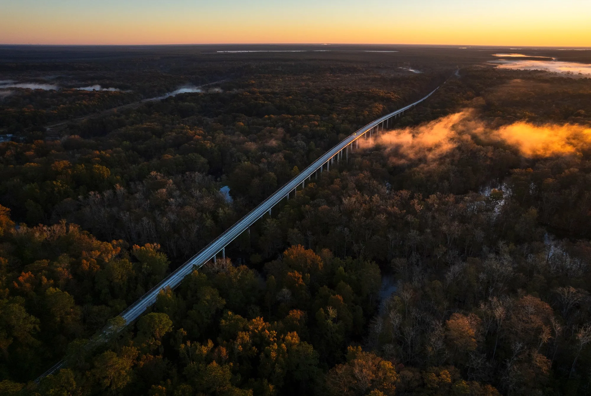
Eureka Bridge: County Road 316 crosses the Ocklawaha River near Eureka, Florida.
I crossed a river for years without ever learning its name. Then one day I looked closer.
Text and Photographs by Matt Benson
It started in the bread aisle at Walmart. An unexpected run-in with a friend while grocery shopping late Friday evening had us driving east toward the Ocala National Forest the following morning in search of a river.
There’s a river that borders the western edge of the Ocala National Forest, flowing north from Central Florida before spilling into the St. Johns. I first noticed it while researching a project on Google Earth, its shape meandering like a vein across my screen. But it would be years of crossing that river before ever going deeper.
I eventually learned that the river is drawn down every few years, exposing natural springs hidden beneath its surface. When I heard the scheduled drawdown had been postponed for another year, I decided to spend that time exploring. It was a cool Saturday morning when I pointed my truck east toward the forest.
I rolled down the window and stuck out my hand. A rush of cold air hit my face. The east-west line of County Road 316 stretched toward a bridge before rising to a peak I couldn’t see over. I pressed harder on the gas. My truck climbed.
Gradually the trees fell away. My hand in the air rose like an airplane wing, and before long I was above the forest canopy, soaring over the swamps of the Ocklawaha River.
For years, crossing the river had come to symbolize a sort of threshold to adventure, a doorway to the forest beyond. But this time the river was the adventure.
I took my foot off the gas. The momentum from the climb shot me over the peak and carried me toward a small road on the other side of the bridge. I took it and descended into the trees.
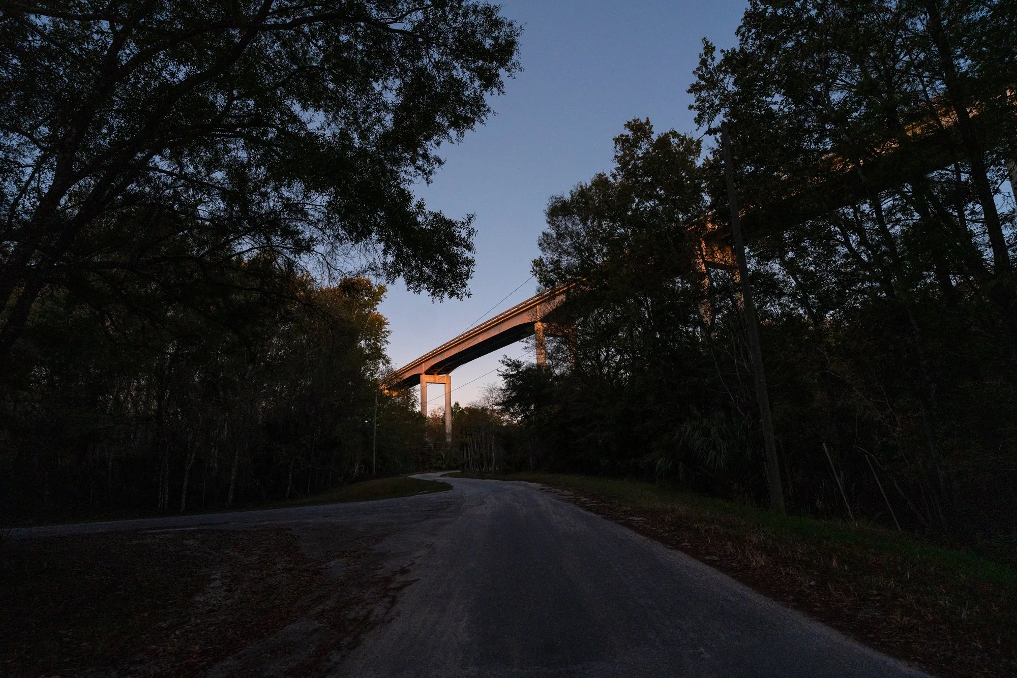
The Eureka Bridge rises above the Eureka East Boat Ramp.
Under the bridge I felt small. To my left, tucked beneath one of the wooden “fenders” originally designed to protect the concrete columns from shipping barge collisions, was a memorial for a Nikki. I wondered who she was and what the river meant to her.
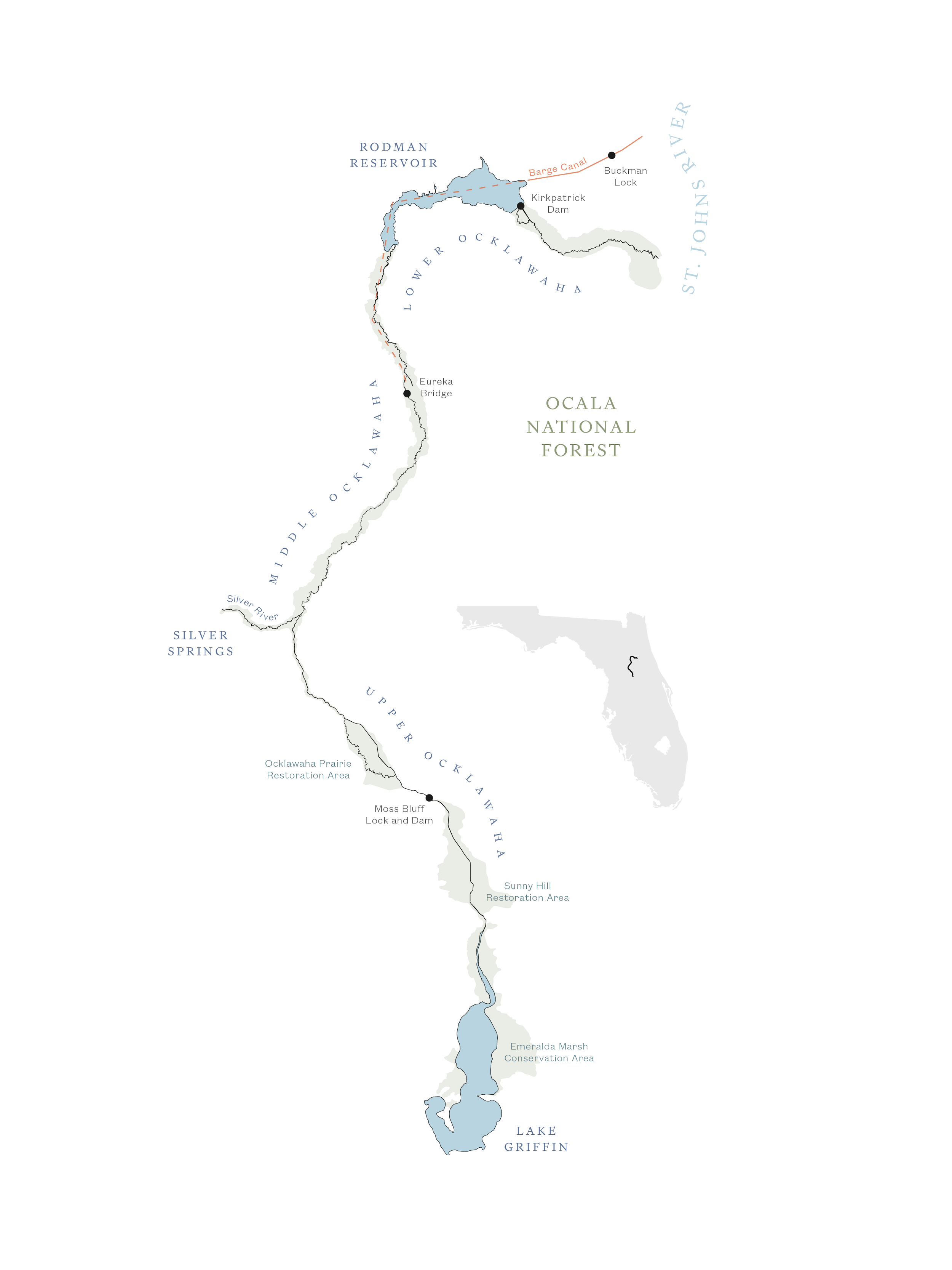
Over the course of a year, I followed the 74-mile Ocklawaha River from its headwaters at Lake Griffin in Central Florida to its confluence with the St. Johns River. During that time, I found that it’s difficult to discuss the Ocklawaha River without mentioning the Cross-Florida Barge Canal, a decades-old failed effort to cut a shipping route across the state.
A quote published by the National Audubon Society in 1970, just two years before President Nixon terminated the controversial canal project, captures the landscape well: “There are two Oklawaha Rivers today. There is the twisting, unspoiled black-water stream of the Florida Wilderness. And there is the dammed, straightened, Army Engineered desolation of the unfinished Cross-Florida Barge Canal.”
More than half a century later, the words still describe the river well: two distinct forms – one carved through the earth over thousands of years, the other dug by human hands in mere decades.
It was the first description that initially captured my attention. But the second kept me coming back. As I followed the river, I found that these two versions of it were so distinct from each other that it was difficult to see them as one united river.
The Upper Ocklawaha looks more like a canal than a river. Large portions were cut and straightened in the early twentieth century to improve navigation, and some sections were bypassed entirely. But blindfolded and dropped into the Middle Ocklawaha, you might think you were in the Amazon.
On an overnight paddle from Silver Springs to Eureka, the river felt prehistoric. Mist hung over the water, and beside us bald cypress towered above like ancient guardians along the bank. Manatees glided beside our boats, periodically emerging for a breath before diving back again. Alligators normally camouflaged in the murky waters were easy to spot atop the crystal surface of the Silver River. And even monkeys played and danced along the cypress knees.
North of Eureka, the Lower Ocklawaha opens into a broad 9,500-acre reservoir before flowing through a dam and out into the St. Johns River. The lower river was severely altered by the barge canal project, when large sections of old-growth cypress forests were cut down to make way for the new shipping route. Stumps from these ancient forests can still be seen protruding from the water during drawdown. The Kirkpatrick Dam, located at the north end of the Ocklawaha River, continues to be a source of debate between residents, anglers, and conservationists.
My original plan was simple: explore the river from Lake Griffin to the St. Johns to better understand its geography and story. But I soon realized the richness of the Ocklawaha River could never be captured through exploration alone. There are parts of the river that only exist in memory. And nearly everyone I met carried a different version of it with them.
Map of the Ocklawaha River
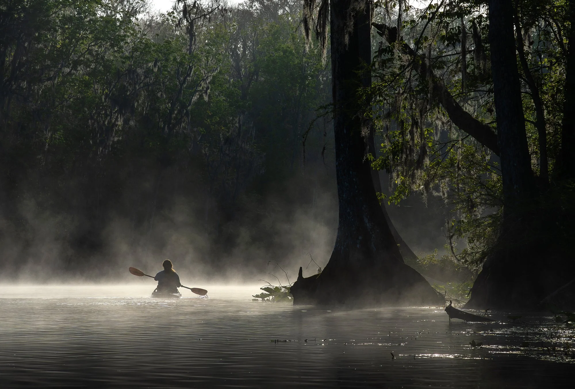
The Middle: Mist hangs over the Silver River on an early February morning during a camping trip along the Middle Ocklawaha.
I arrived at the boat ramp outside the unincorporated town of Hog Valley and waited in the dark. A gray pickup truck towing a 16-foot fishing boat reversed beside me and then stopped. The driver rolled down the window. He was wearing a brown camouflage shirt and a hat that read, “Kiss My BASS.”
“Matt?” he asked. I confirmed, and then he said, “Harvey. Nice to meet you.”
I was eager to learn about the Ocklawaha River from both sides of the Kirkpatrick Dam debate. Some wanted the dam removed and the river restored, and it wasn’t difficult for me to understand that perspective. Restoration sounded like a positive thing, after all. But still, others wanted the dam to remain, and I was curious to know why.
I was given Harvey McGuire’s information by a local bass fishing guide, and after a brief introduction, we boarded his boat. We spent two hours touring the reservoir, driving through the Ocklawaha River channel, the barge canal, and some of McGuire’s favorite fishing holes. He took me past the few houses visible from the reservoir and told me about the residents who live in them – an airboat repairman, a woman who serves on the board of Save the Rodman Reservoir, a retired exterminator.
At one point McGuire stopped the boat and paused to look around.
“Just look at this,” he said, stretching his arms wide to encompass everything around him. “This is just beautiful, isn’t it? … I wanted to be here. And we came. We made it happen.”
Eight years ago McGuire and his wife sold their tree trimming business in Lakeland, Florida, and moved to the Rodman Reservoir in pursuit of a simpler life. Though mostly retired, McGuire supplements his income through an Airbnb rental called “Camp My Way,” which is located on the reservoir. He also owns a small shiner business, McGuire’s Mobile Bait, where he supplies live shiner to local bait shops for $1.25 apiece. McGuire catches his shiner from the reservoir and says they are the preferred bait choice of serious bass anglers.
McGuire also serves on the board of Save the Rodman Reservoir, a non-profit organization dedicated to preventing the destruction of Rodman Reservoir, according to the website. Each year the organization hosts a bass fishing tournament, and the proceeds are used to keep the Rodman Reservoir intact.
I asked about his position on the dam, and McGuire repeated the phrase, “Two wrongs don’t make a right.” Like others in favor of keeping the dam, McGuire said that despite the initial destruction caused by the construction of the Cross-Florida Barge Canal, nature has since adapted and created a new ecosystem. He said that to ruin the new ecosystem in favor of restoring the Ocklawaha River would only cause further unnecessary damage.
The Rodman Reservoir is famous for its largemouth bass and is considered one of the premier lakes in the country for producing trophy fish. “I’m telling you,” Harvey said, “even the five-pounders will fight you all the way to the boat. They’re healthy in this lake.”
As he picked a piece of trash off the ground following our adventure, McGuire told me it saddened him to think of the reservoir being drained. This is where he and his wife made a home. Breaching the dam and draining the reservoir would likely reduce his property value and his ability to earn income through his businesses. He said he doesn’t believe the dam will be removed, but that if it were and the reservoir drained, that he would remain in his house and accept a longer walk to the water.
My experience with Harvey McGuire helped me realize how complex the river and the politics surrounding it are. Many people aren’t just defending different opinions about the river, they’re defending entirely different memories of it.
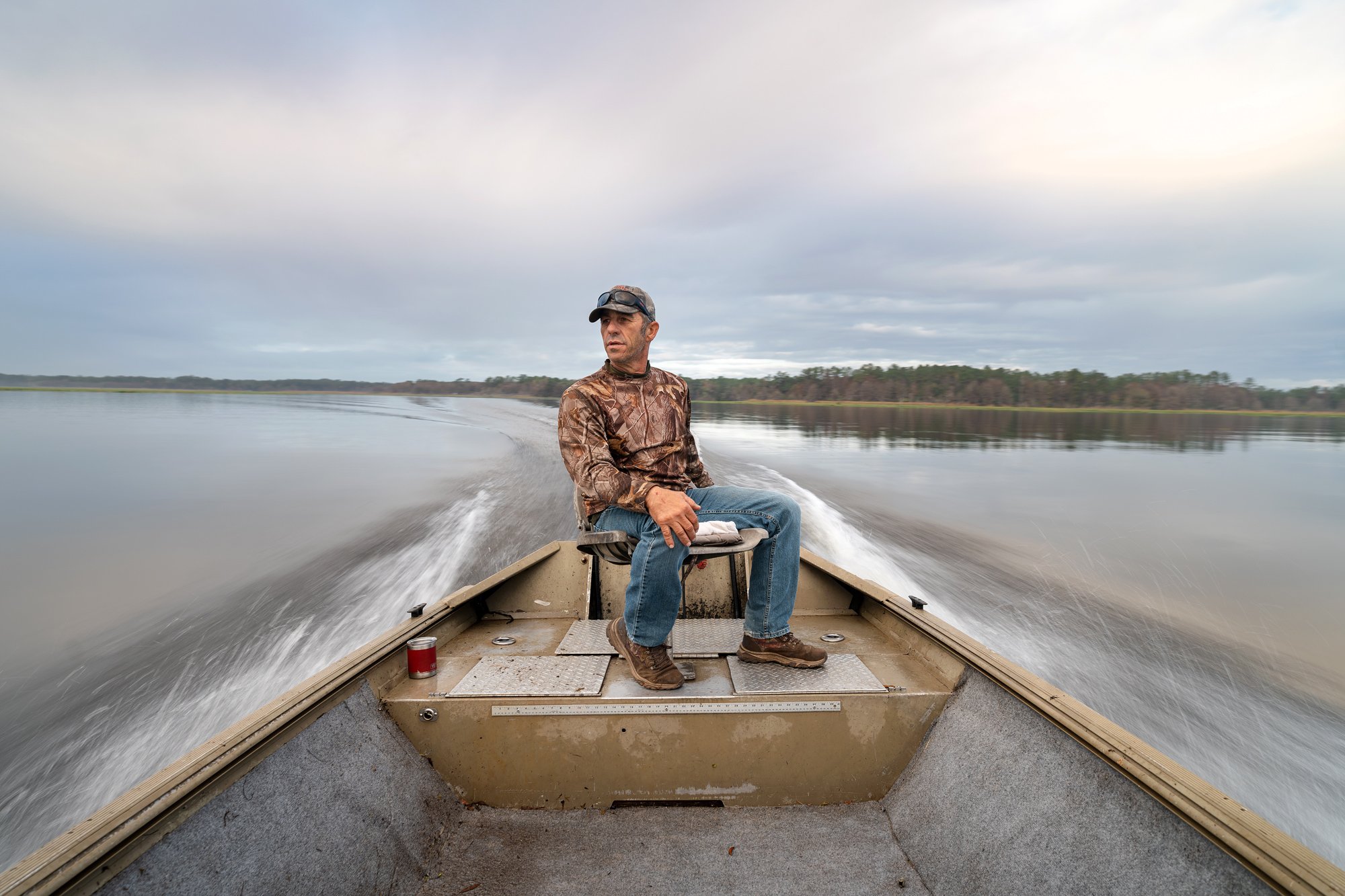
Home on the Reservoir: Harvey McGuire drives his boat across the Rodman Reservoir, where he and his wife bought a home in 2018.
Captain Erika Ritter remembers the Ocklawaha before the destruction, when the springs ran clear and the stripers spawned in the swift, cool waters.
She was only a child when it started to change – six years old when President Lyndon B. Johnson stood in Palatka at the Cross-Florida Barge Canal groundbreaking ceremony and suggested the canal would “create a value where none existed before.” Ritter was 10 when the Kirkpatrick Dam was completed and the river flooded.
“I have a vague visual of it as a child,” said Ritter, now 68. “My interpretation was that they were taking my river away. By the time I was 12, I was two years into this thing being destroyed.”
It was twilight when I met Ritter at the Eureka West Boat Ramp on a Saturday morning in April. She and her late ex-husband started the first pontoon charter on the river in 1983. Today, Ritter provides private tours aboard her 1990 Harris FloteBote, the Anhinga Spirit.
We boarded her pontoon boat and headed north, following the river downstream through a stretch Ritter calls her childhood backyard.
Ritter is a sixth-generation Floridian. Her ancestors moved to the area in the late 1800s following the Civil War, and her grandparents eventually built a log cabin on the Ocklawaha River in the small town of Eureka, where Ritter lives today.
As we meandered around the cypress-lined bends, Ritter told stories of her childhood: the time in fourth grade when her mom, Gwen Ritter, tested Erika’s eyesight by handing her a rifle and pointing to a squirrel in the trees. Good thing for the squirrel, it turned out she needed glasses. And the time when her mom rerouted an approaching construction crane, subtly reshaping a small corner of the barge canal and saving that section of the Ocklawaha River.
It was said the Cross-Florida Barge Canal would bring jobs and economic growth to rural towns like Eureka. But according to Ritter, the majority of locals were against the project. Her father, Tex, was one of the few exceptions. After contracting malaria in the Philippines during World War II, he hoped construction would help kill the mosquitoes.
“I had to hear about my mom crying because the river was being destroyed, and my dad saying, ‘It’ll get rid of the mosquitoes,’” Ritter recalled.
But her mom never stopped fighting. Gwen Ritter remained a vocal defender of the river until her death in 2013. Even now, people call Erika “Mrs. Ritter’s daughter” – a title she wears proudly.
~~~
The 24-foot Anhinga Spirit rounded a bend and slowed to a stop. A school of longnose gar was spawning in the shallows, and we waited in dead silence for the female to leap from the water in a strange, primordial dance.
There is a general perception surrounding the Kirkpatrick Dam debate that those who support keeping the dam are fishermen, while those in favor of removing the dam and restoring the Ocklawaha River are simply environmentalists. But my journey with Ritter revealed a more complex narrative.
Near the back of her boat, tucked inside a beige and red tote bag, were three family photo albums. I had asked if she might share any family photos, and these are what she brought.
Inside the old yellowed pages lay a legacy of fishing on the Ocklawaha: men, women, and children – her family and friends – proudly holding their catches. Monster largemouth bass, striped bass, channel catfish the size of your thigh, stringers of river bream. Many of the photos were taken between the 1930s and 1960s, before construction of the barge canal and dam.
In one photo, Ritter holds a striped bass, or “striper,” beaming at the camera after a late-night trip to Salt Springs. A group of men fishing nearby had offered to help but quickly realized how capable she was.
By that time, stripers were rare on the Ocklawaha River, a side effect of the dam. According to Ritter, striped bass live in saltwater but require a long and swift channel of freshwater in which to reproduce. The historic connection between the Atlantic Ocean, St. Johns River, Ocklawaha River, and Silver River had made this the only viable spawning route for stripers on Florida’s Atlantic coast. When the dam went up, the fish were shut out.
Ritter believes it will be the manatees who ultimately save the Ocklawaha. People tend to be more sympathetic to them than to fish. But she said it’s the fish who are suffering the most. Manatees can still migrate through Buckman Lock between the St. Johns and Ocklawaha rivers. The fish cannot. Striped bass, American shad, and other migratory species once common in the Ocklawaha have vanished upstream.
“There’s a generation or two or three that has no idea what the fish looked like,” Ritter said.
Some anglers claim breaching the dam would destroy the prized largemouth bass fishery in the Rodman Reservoir. But Ritter’s photos suggest that trophy-sized bass were pulled from the river long before the reservoir existed.
The Ocklawaha River is also home to 20 freshwater springs, currently submerged beneath the flooded waters. Ritter took me to Cannon Spring, a third-magnitude spring and one of the largest of the 20. Accessible to the public only by water, it appeared beautiful even through the dark river. But Ritter said it looks completely different during drawdown, when water levels drop and the approach from the river runs crystal clear.
Over the years, Ritter has hosted all kinds of passengers on her boat, from artists and photographers seeking out Cannon Spring, to scientists, journalists, and even prospective residents of the reservoir. Like the steamboat captains of the 19th century, Ritter offers access to a world unknown by many Floridians.
“I don’t think people know what wilderness looks like anymore,” she said. “People need to get out here and see it.”
As we passed Indian Bluff and entered Cypress Bayou, a section of the river where the cypress trees are dying beneath elevated water levels, Ritter pointed to the passing houses and said, “I’ve taken most of these people out on my boat, and they understand.” She believes many residents who live along the reservoir quietly support restoration but don’t speak up for fear of clashing with neighbors.
After decades of advocacy, resistance, and bureaucratic delays, Ritter admits the fight has worn on her. “I just want my river back,” she said.
Still, she remains confident restoration of the river is inevitable. “It’s not if,” she said. “It’s when.”
~~~
When we returned to the boat ramp, we spent more time flipping through the photo albums. There was one photo tucked inside those yellowed pages that stayed with me. It doesn’t show a trophy-sized largemouth bass, or a striper, or a catfish the size of your thigh. It’s a simple photo, one that might be overlooked at first glance.
In it, a 10-year-old Erika Ritter sits near the construction site of the Eureka Bridge – the same bridge I crossed for years before learning about the river. Behind her, men are working. She’s turned from the camera, looking back over her shoulder, not smiling, but glaring.
I’m drawn to the photo partly because of the bridge. But I also can’t help but feel that it reveals something deeper about Ritter. A young girl staring down the lens, already discontent with the idea that a river’s value must be proven, quantified, reshaped. Even then, she appeared to understand that the river didn’t need to be improved. It was already valuable.
To me, that photo captured more than a child at a construction site. It foreshadowed the woman she would one day become – one who has spent a lifetime fighting for the river she loves.
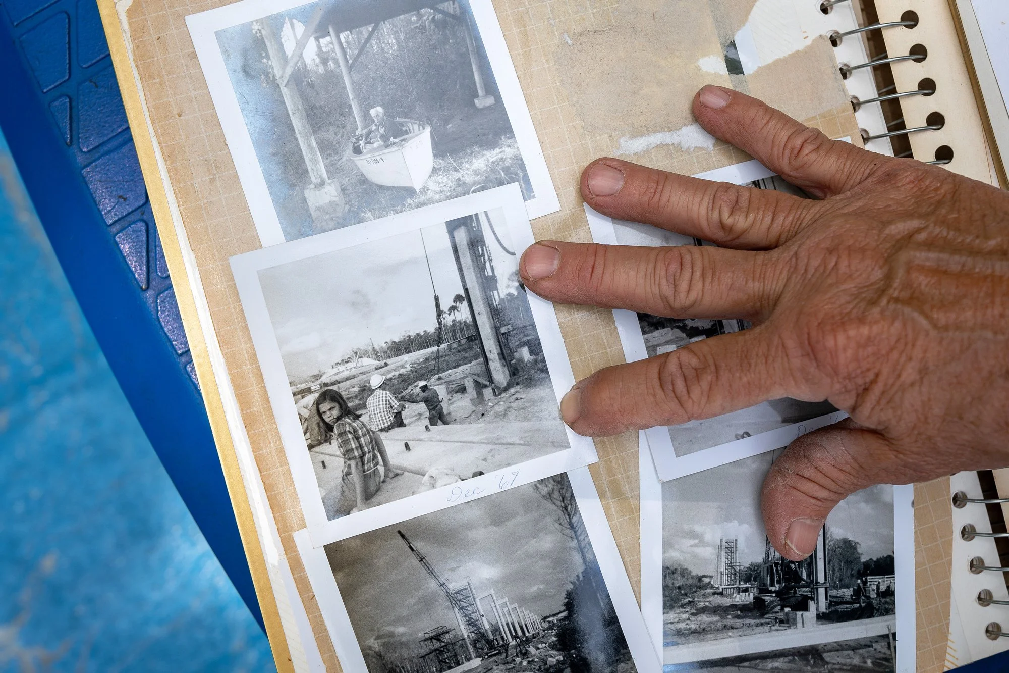
Family Legacy: Erika Ritter looks through family albums documenting generations of life along the Ocklawaha River. Among them is a photograph of Ritter at 10 years old near the construction of the Eureka Bridge.
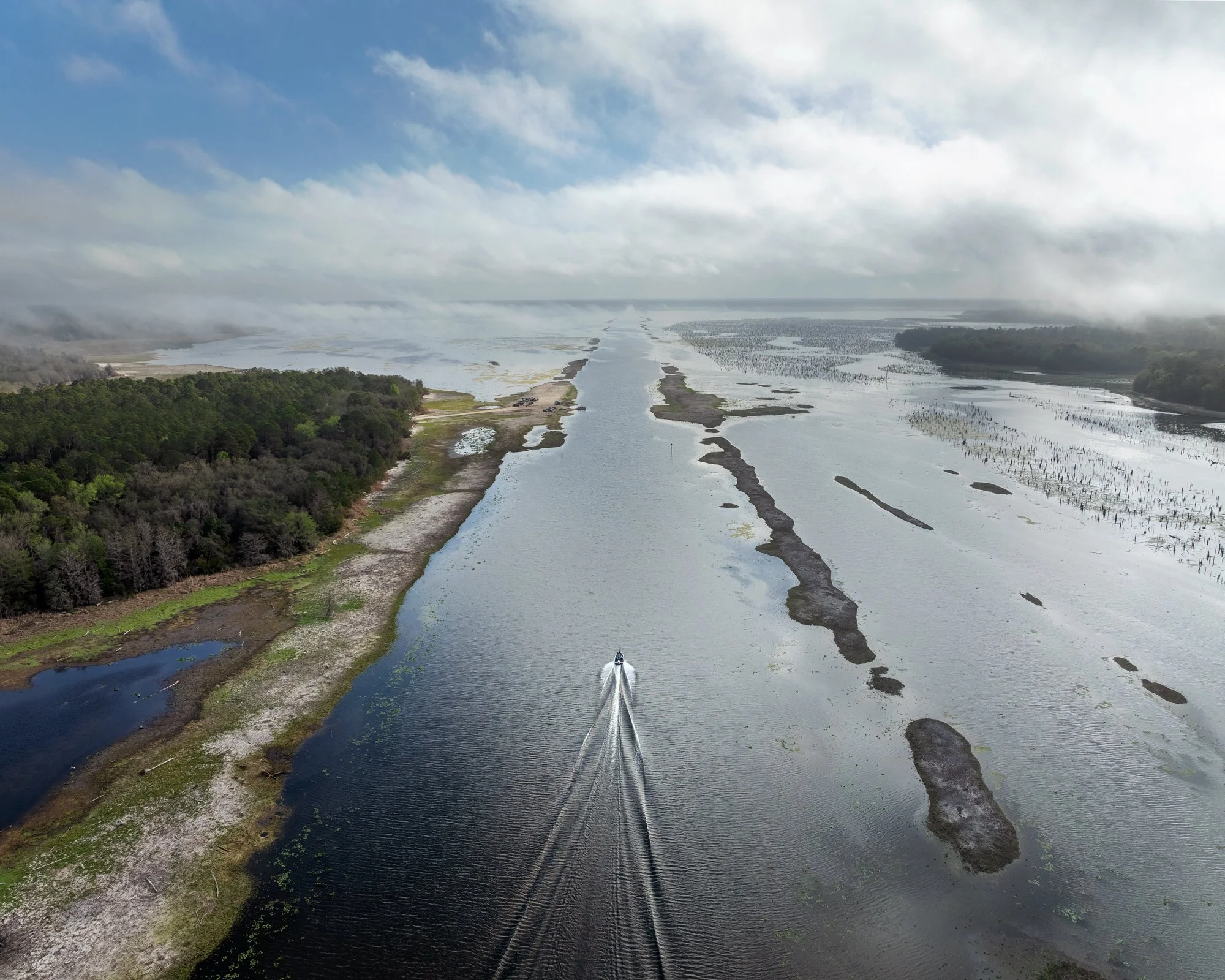
A boat travels through the exposed channel of the Cross-Florida Barge Canal near the Kenwood Boat Ramp during the 2025-26 drawdown. To the right, the Ocklawaha River winds through old cypress stumps.
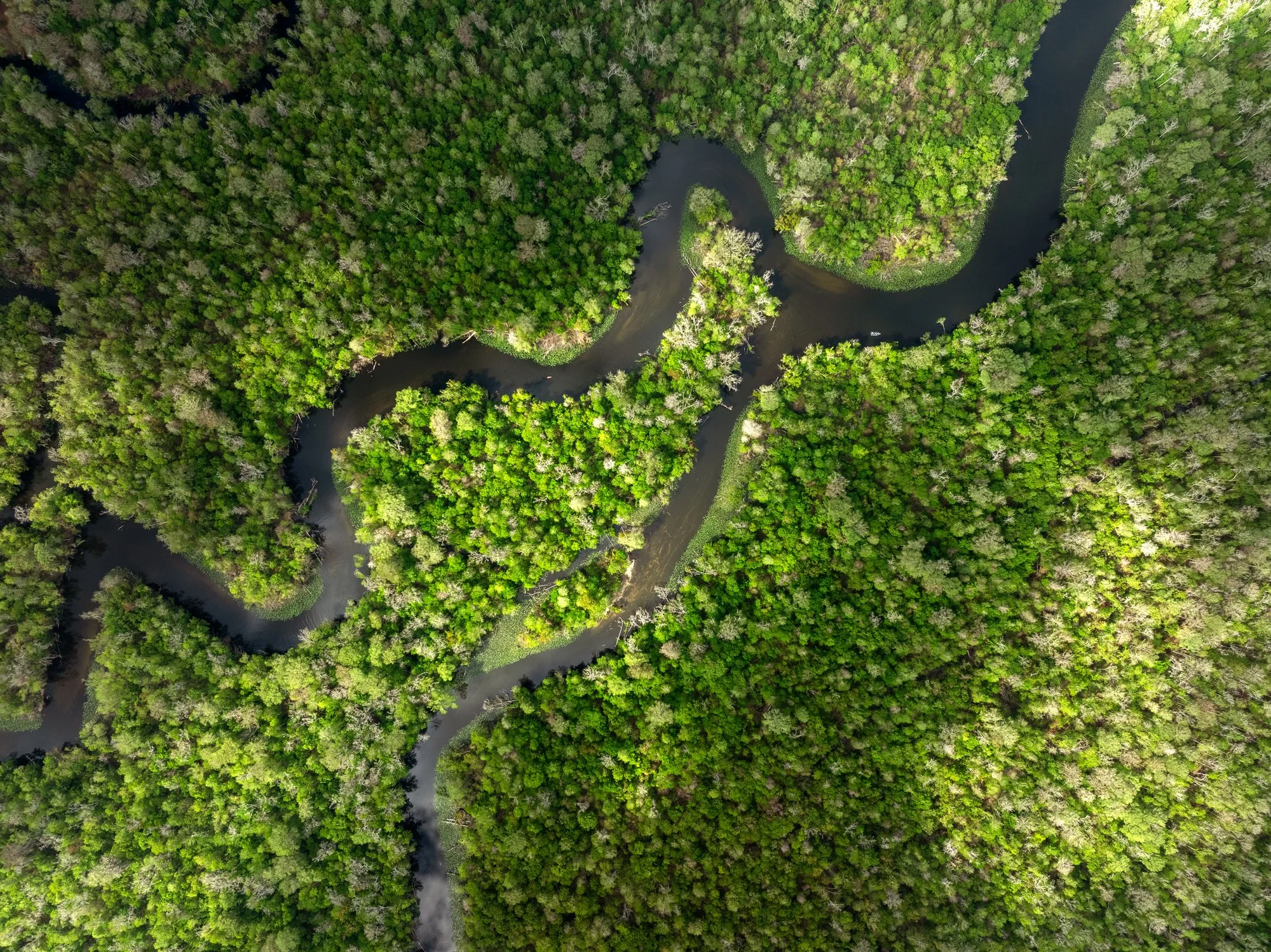
A section of the Lower Ocklawaha east of the dam flows toward the St. Johns River. The approximately ten-mile stretch between the dam and the St. Johns River was left mostly undisturbed during construction of the Cross-Florida Barge Canal.
Paddling the Ocklawaha is an exercise in surrender. Each bend in the river is quickly followed by another, an endless rhythm. Paddle too hard and you’ll overshoot, crashing into the cypress knees. Hug the inside too closely and the current whips you into the lily pads. Downed trees and other debris require proactive attention. But get it right – embrace its rhythm, conform to its pace, anticipate its obstacles – and time melts.
The scheduled drawdown came and went. For three months springs emerged, water became land, and the stumps of the ancient forests breathed for the first time in six years.
I returned to the reservoir to witness the seven-foot drop in water. A trek across a dry lakebed revealed the remains of old trees and bottles dating back to the 1960s, possibly left there during the barge canal construction.
I thought back to my time with Harvey McGuire and reflected on something he said – that he found the reservoir ugly during drawdown. But I couldn’t help seeing something strangely beautiful in the combination of wilderness and destruction. A history buried beneath the reservoir.
The drawdown made it impossible to see the reservoir as anything other than a man-made creation.
Months earlier, during a camping trip, I waded into the river at dusk and felt the slimy bottom ooze beneath my feet. The river was still, quiet. Peaceful. Only two boats passed us that evening. I stripped to my underwear and bathed in the cold water before retiring to the tent.
That night, as I stared at the warm glow of our tent among the darkening river, I thought about all the versions of the Ocklawaha I had encountered. The river not yet lost. The river not yet restored. The river in between.
To Harvey McGuire, the drawdown exposed something ugly. To Erika Ritter, it revealed something lost. And somewhere beneath it all, the river flowed north.
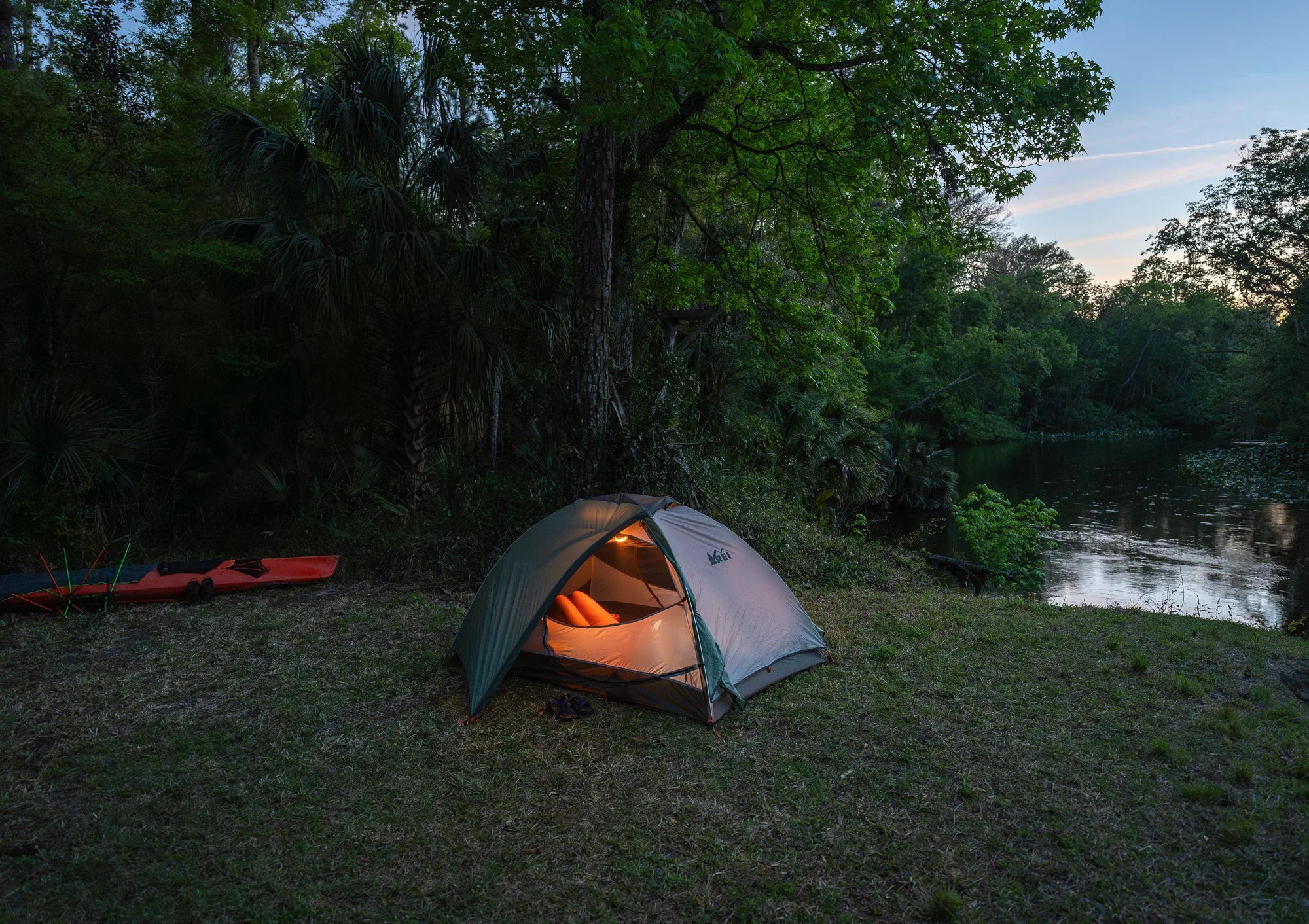
Evening settles over our campsite along the Ocklawaha River.
Ocklawaha was originally self-published as a book.
View the book here.
Photographed, written, and designed by Matt Benson
Photographs made 2024–2026
© 2026 Matt Benson