Day Off - Kayaking the Ocklawaha River
A video I made kayaking the Ocklawaha River on my day off
Crooked as the Ocklawaha River
Street lights dashed by the window as I shot down State Road 20. They ended a few miles later, somewhere between Gainesville and Hawthorne, and I flung into darkness.
The city was sleeping, except for a few construction workers already dressed and stumbling the sidewalks to their respective job sites. I felt bad for them. I was driving east towards Palatka, Florida, with a truck full of camera gear and a boat.
There’s a section of the Ocklawaha River, between the Rodman Reservoir and where the river enters the St. Johns, that I’ve been eager to photograph. It’s a section packed with meandering tributaries, and one that, I imagine, was the inspiration for Penny Baxter’s quote in The Yearling: “My words was straight, but my intention was as crooked as the Ocklawaha River.”
I figured the area would present a cool composition from the sky, and since I recently purchased a drone, that thought had become a possibility.
Option 1 - Rodman Dam kayak launch area
Option 2 - Johnson Field boat launch area
The Image
The plan was straightforward: paddle my kayak into a predetermined section of river, send up the drone and take the photo. But there were a couple obstacles.
The first obstacle was finding a promising section of river close enough to a boat ramp. I wasn’t comfortable launching the drone from my kayak, so I had to find an area where I could launch from land, paddle out for the shot, and then return to the launch site in order to land the drone safely, all before the battery died. I scouted some locations using Google Earth (screen shots above) and decided to go with the Rodman Dam kayak launch thanks to a suggestion from Alex.
I hadn’t realized while planning the trip just how high my drone would need to be to replicate the field of view captured in the Google Earth screen shots. By the time my drone approached even half the altitude, my kayak was an invisible speck. This meant that if I wanted the kayak to be in the shot (and I did), I wouldn’t be able to capture the bends in the river — at least, not at the location I chose.
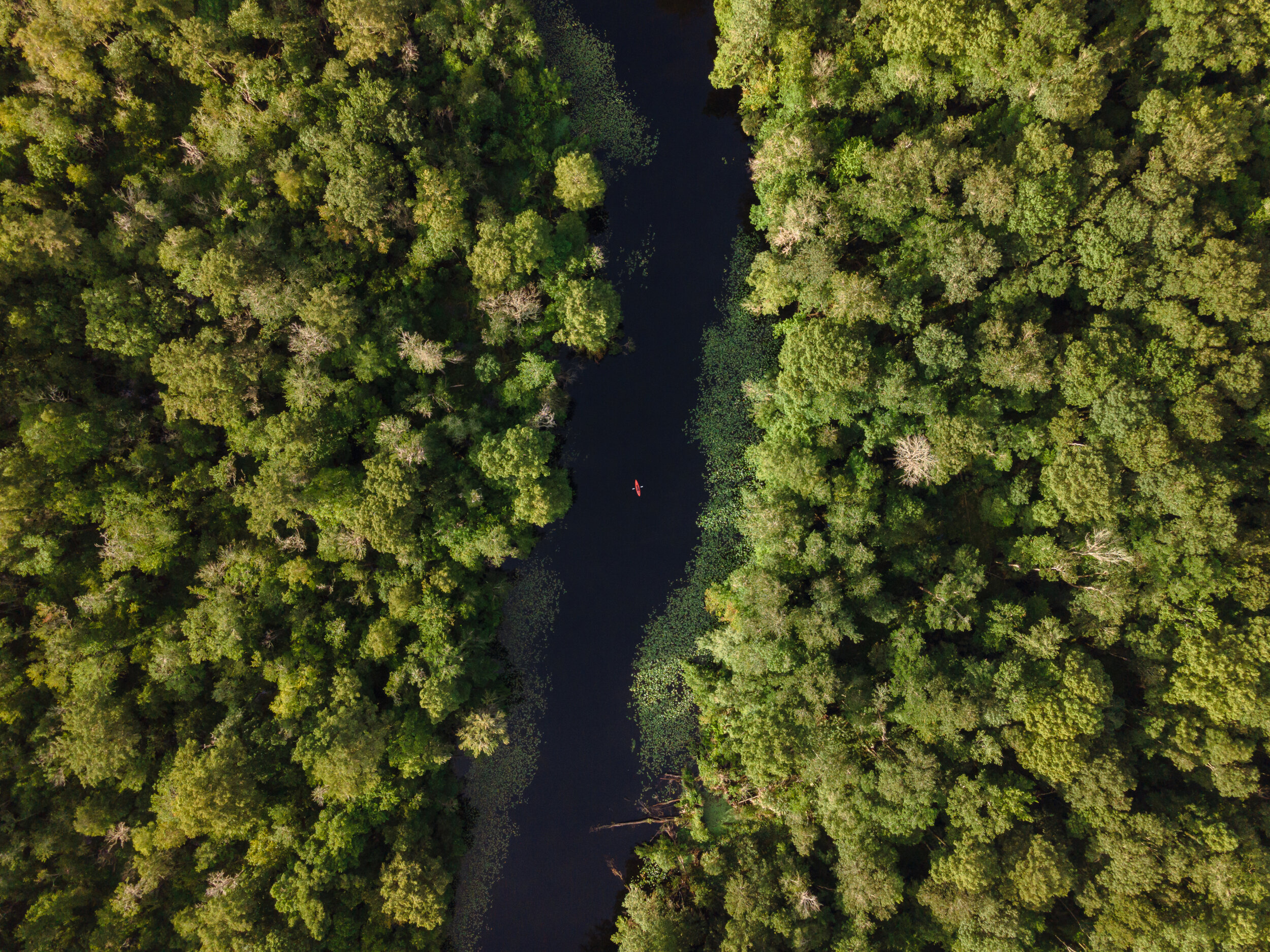
Instead of reorganizing the entire trip, I took an image and turned my attention to capturing video. I set a goal to start creating more video content, and this was a good opportunity to do that.
My kayak floats in the middle of the Ocklawaha River. This is where owning an orange kayak really comes in handy!
The Video
This was my first time back in the wilderness since Zion was born five months ago, so I wanted the video to capture that feeling of reunion. I wanted it to be an experience.
I created a simple storyboard prior to the trip and determined two critical shots. The first was an aerial view of my truck driving down the road, which would then transition into the second shot, an aerial view paddling down river. Because I was by myself, I relied on the Active Track feature of the DJI Mavic Air 2 to film these two shots. This was my first time testing the feature.
There were some close calls while using Active Track, the most notable occurring during the truck scene when the drone flew directly into a low-hanging tree branch (see below). Thankfully it navigated itself through unscathed. Overall, the Active Track feature worked well and allowed me to capture the shots without a second person.
The Mavic Air 2 comes nerve-rackingly close to hitting a tree branch while using the Active Track feature.
The Drive Home
Thunderstorms were forecasted throughout the afternoon, so I packed my things and started back.
The drive home was filled with a mixture of emotions. One thing you learn as you become a new parent is that you don’t get a day off, at least not very often. So I was thankful to have had a morning all to myself. But I was also sad that Jenny and Zion couldn’t be there with me. They are my adventure, and experiences feel a bit hollow without them.
One day Zion will be old enough to join us on these adventures. And while I’m certain it will bring a new set of obstacles, they are obstacles I happily look forward to.
Rain streaks down the driver side window on my way home.


