Waterways
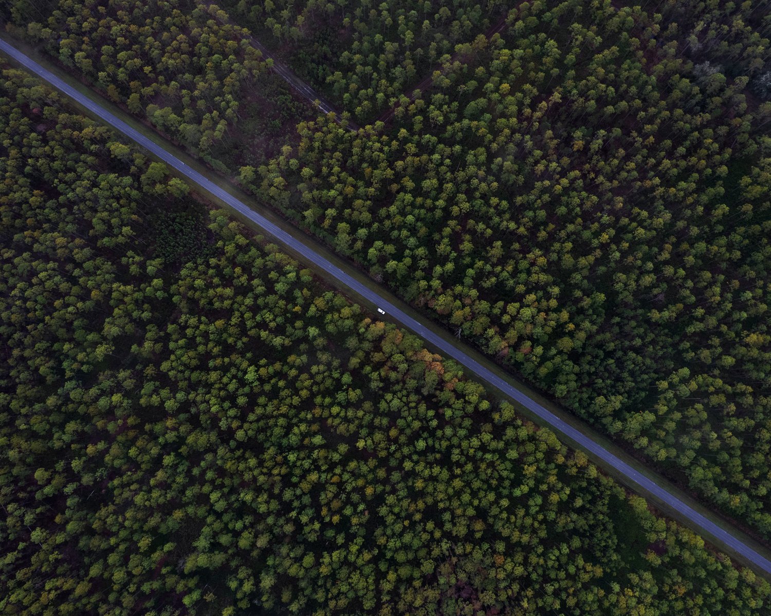
The Cross Florida Barge Canal cuts through the landscape like a scar before entering the Rodman Reservoir in north-central Florida.
Hidden Springs
It started in the bread aisle at Walmart. A serendipitous encounter with Alex while grocery shopping late Friday evening had us driving east to the Ocala National Forest the following morning in search of waterways.
There are springs hidden beneath the surface of the Ocklawaha. They are revealed for just a few months every three to four years when the Kirkpatrick Dam (formerly Rodman Dam) is opened and the reservoir drawn down for maintenance. Jenny and I planned to see them for the first time this winter, but the drawdown was postponed until next year due to high water levels in the St. Johns River basin.
I’ve paddled the Ocklawaha on a few occasions and have grown more curious about the river. Like much of Florida, the Ocklawaha River is a casualty of human ambition and ignorance, currently caught in the middle of a political struggle between people who advocate for removing the dam and returning the river to its natural state and others who fish the reservoir and want to keep the dam.
My plan is to spend the year-long postponement exploring and learning more about the Ocklawaha River prior to next year’s drawdown.
I returned from Walmart at 9 p.m. and put away the groceries. There wasn’t much time to prepare an impromptu morning trip if I wanted to get any sleep, but I managed to pack a bag, charge my camera batteries, and plot three points on a Google Earth map: the Cross Florida Barge Canal at SR-19, the Kirkpatrick Dam, and the CR-316 bridge in Eureka.
The morning came fast. I cooked some eggs and slipped outside into the dark.
Three points I marked on a map the night before: Point 1 - Cross Florida Barge Canal at SR-19; Point 2 - the Kirkpatrick Dam; Point 3 - CR-316 bridge in Eureka.
Sunrise in the Ocala National Forest Saturday morning.
Looking up.
Looking down.
Point 1: Looking east, the Cross Florida Barge Canal passes beneath SR-19 as it flows from the Rodman Reservoir to the St. Johns River. The canal was intended to connect the Atlantic Ocean and the Gulf of Mexico, allowing shipping barges to pass from one side of Florida to the other. The project was eventually halted by President Nixon in 1971 due to environmental concerns and is considered the largest uncompleted public works project in American history.
Alex records deer on his phone during our drive to the Kirkpatrick Dam.
Point 2: Looking west, the Kirkpatrick Dam and the Rodman Reservoir behind it. The dam was built in 1968 by the Army Corps of Engineers as part of the Cross Florida Barge Canal project. During drawdown every three to four years, the original Ocklawaha River channel is exposed, along with many natural springs and a graveyard of old cypress forest that was obliterated as part of the project.
Bobcat
After photographing the barge canal and dam, we drove south to the Juniper Prairie Wilderness for lunch. We hiked out a small distance and set our chairs beneath a familiar pine canopy.
I don’t know how long it had been following us. I didn’t notice until it was only a few feet away, and when I turned around and saw it I jumped with surprise and yelled some sort of expletive at Alex.
A bobcat. Male. Probably a juvenile — not really a kitten, but not yet a mature adult. He was cautious but curious, and he approached us similar to how a house cat would approach a new visitor.
It seemed likely that he’d had previous encounters with people. Looking back on it, I think the proper response would have been to scare him away — instill a little fear of humans in him. But Alex and I were caught up in the moment and excited. We instinctually proceeded to photograph him.
Encounters like this are rare. I’ve made more than 60 trips to the Juniper Prairie Wilderness over the past seven to eight years, and this is the first bobcat I’ve seen. The only experience that comes close is the time a black bear stumbled into our campsite before immediately running off.
We finished our lunch and returned to the truck. The bobcat followed us most of the way, but he stopped shy of Forest Road 33. When I started the engine he was gone.
Looking southwest over the 14,000-acre Juniper Prairie Wilderness, with Forest Road 46 (right) leading off to the west and Highway 19 (left) leading south.
A bobcat camouflages in the undergrowth of the Juniper Prairie Wilderness area in the Ocala National Forest.
Eureka
The third and final point on our map was the Eureka bridge. There were people at the boat ramp, so we parked the truck before the turn and took pictures as a storm rolled in.
It’s funny — I often joke that the only good thing to come out of my UF journalism degree is Jenny. But I realized this trip that journalism is exactly what I enjoy doing. Exploring, learning, making photographs, writing, telling stories. Being curious about the world. Fitting that this realization came in Eureka.
This post is the first in what I hope becomes a larger series dedicated to the Ocklawaha River and its controversial existence.
Point 3: The Ocklawaha River passes beneath the CR-316 bridge in Eureka, Florida, as a storm rolls in Saturday afternoon.
Alex sits in the truck bed while I photograph the Eureka bridge, which was constructed in 1969 as part of the Cross Florida Barge Canal project. Had the project continued, barges would have passed beneath this section of bridge.
Alligator remains float in a swamp near the Ocklawaha River.


