
A Temporary Landscape
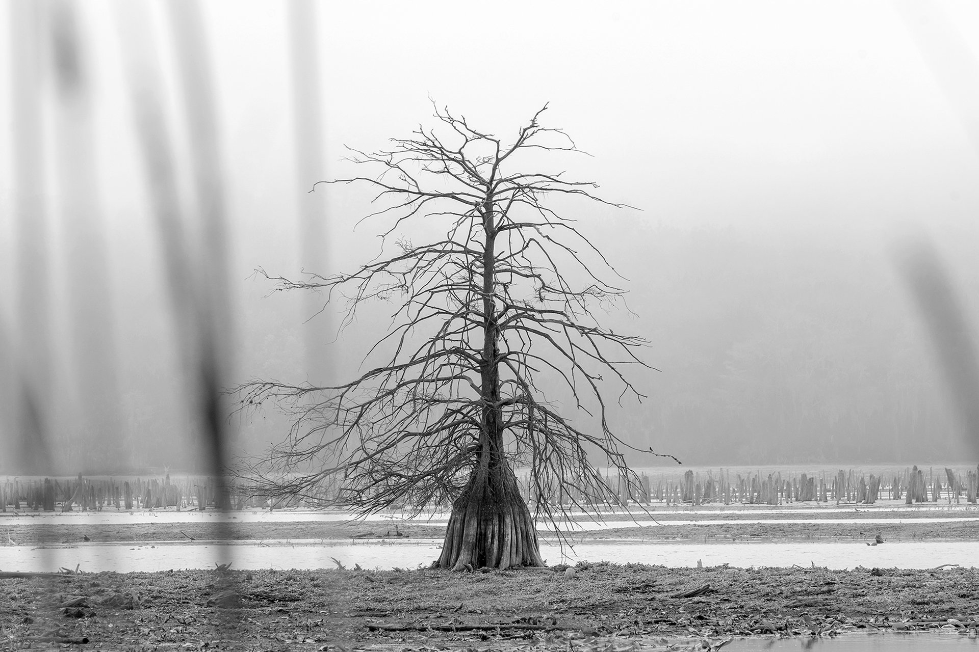
A bald cypress tree stands alone among the exposed remains of the Rodman Reservoir during the 2025-26 drawdown.
Field Notes
I drove to the reservoir early Friday morning to get one last look at the drawdown. In about a week the gates at Rodman Dam will close, and the water will rise seven feet.
It hasn’t been easy documenting the drawdown. A mix of personal challenges and the usual responsibilities of life have left me feeling uninspired. But I was committed to visiting one last time before it ended.
The plan was simple: drive to the dam at sunrise and capture an aerial panorama of the reservoir. I made a similar photograph in November, about a month into the drawdown, and I wanted to repeat the same vantage point to see how the water level had changed.
I packed my camera gear and coffee and left before dawn.
It was an eerie morning. The headlights of my truck caught the glowing eyes of deer grazing along the highway as I passed. A blanket of dense fog covered everything, and I knew that the aerial photograph at sunrise wouldn’t work. If the drive was this foggy, then the reservoir would only be worse. I needed to change plans.
There’s a boat ramp at the Kenwood Recreation Area in Interlachen that I hadn’t visited before. It’s a popular place for anglers launching into the reservoir. During drawdown, when the water level drops too low for the main ramp, a temporary launch area is set up at the end of a long dirt road along the cut of the barge canal.
I decided to investigate.
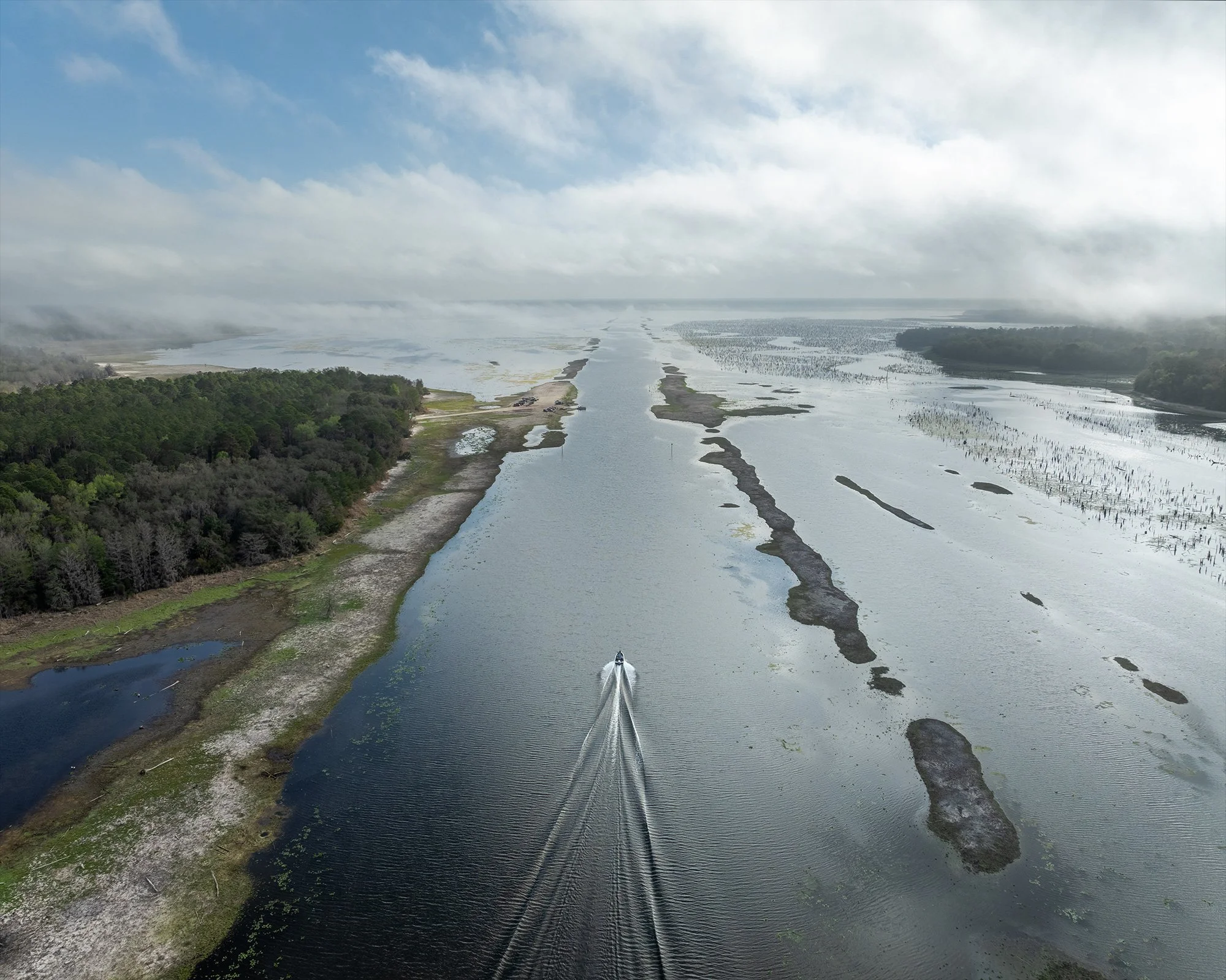
A boat speeds down the cut of the barge canal on its way back to the temporary Kenwood Recreation Area boat launch. The barge canal is exposed during drawdown when the water level drops from 18-20 feet to 11 feet above sea level.
I arrived at the entrance to the temporary ramp about forty-five minutes before sunrise. A possum scurried across the dirt road in front of me and disappeared into the brush.
The road was rough and curved through the trees before opening into darkness at the edge of the reservoir. A truck was already launching a boat near the water, so I pulled off along the side of the road.
Over the next fifteen minutes, more trucks pulling boats arrived. One by one they filled the temporary parking area, and it became clear this wasn’t the quiet place I was hoping for.
I decided to backtrack to the main Kenwood Recreation Area parking lot, assuming it would be empty due to the lack of a functional boat ramp. I was right.
By the time I parked, first light was beginning to filter through the fog.
I had spotted a lone cypress tree in the distance while at the temporary ramp. It stood farther down the bank, and I thought I might be able to reach it from the recreation area. I launched the drone to scout.
The entire lake surrounding the area was dry from the drawdown. The bones of old trees scattered the landscape. And then I saw it: the same cypress tree I had spotted from the other ramp.
The only problem would be getting there.
To reach it, I would have to traverse a lakebed that just five months earlier had been covered by seven feet of water. I had no idea how dry the ground would actually be, or if it would even be possible.
I was glad I brought my boots.
I laced them up, locked the truck, and set off across the lakebed.
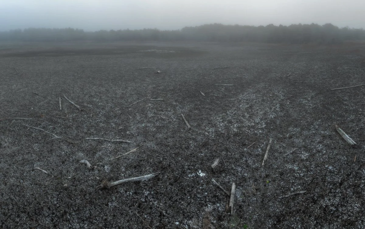
Old tree remains scatter the bare lakebed near Kenwood Recreation Area.
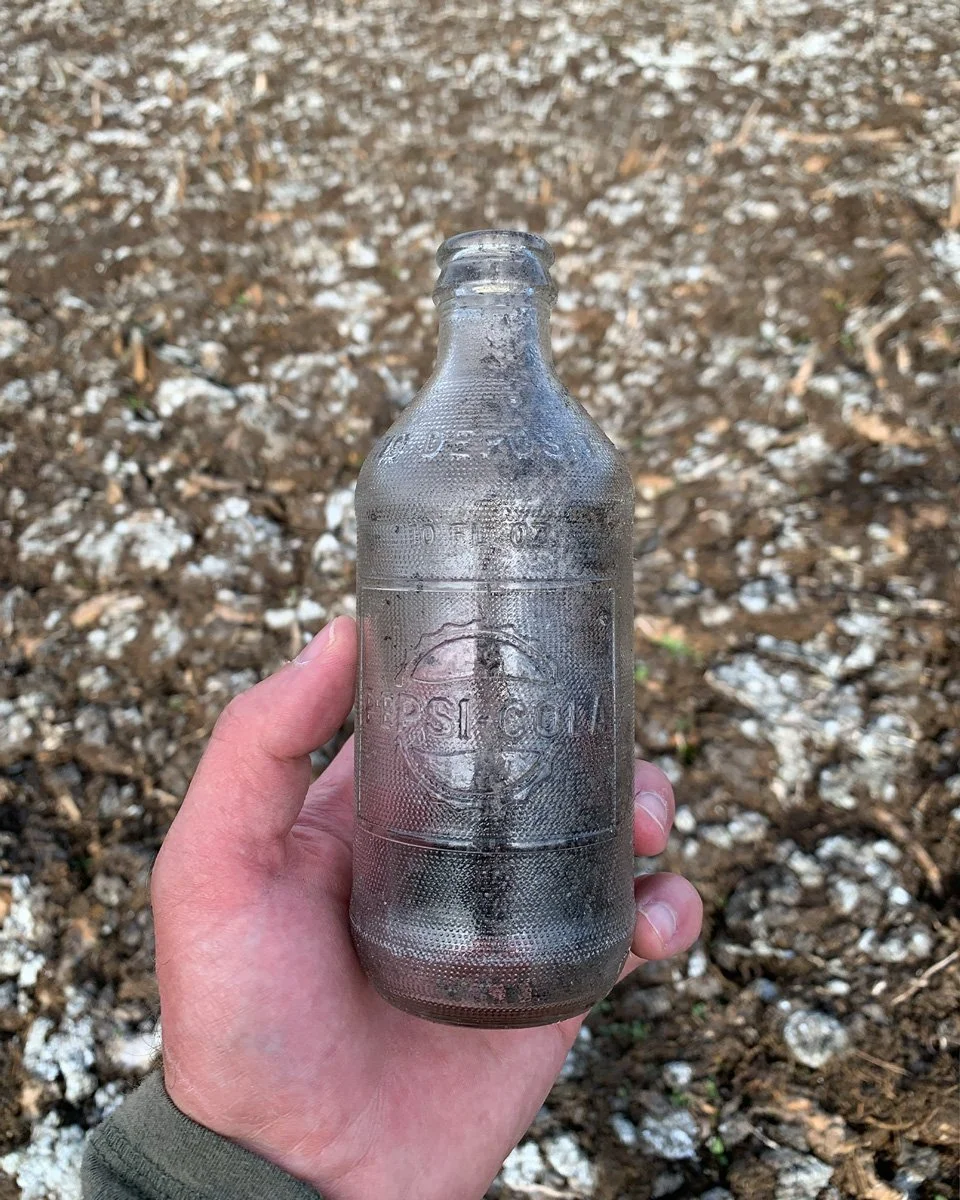
1960s Pepsi bottle
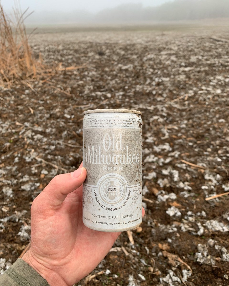
1970s Old Milwaukee can
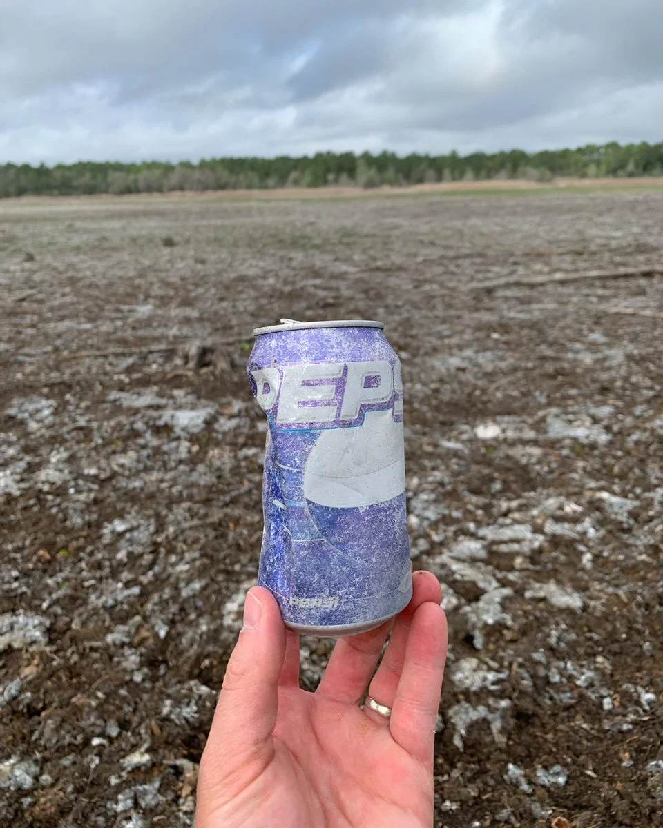
Late-1990s Pepsi can
I was relieved to find the ground mostly dry, though I didn’t trust it entirely. Even after months of drawdown, patches of soft mud still lurked beneath the surface. I moved carefully, testing each step before committing.
The lakebed was a ruin of dead trees and scattered artifacts. Old bottles and cans lay among the debris. Some dated back to the 1960s, possibly left behind by workers constructing the barge canal.
I continued along the edge of the tree line, expecting the ground would be firmer there. After a little more than half a mile, I rounded a stand of dead cattails and finally saw it.
The cypress tree stood alone in the fog.
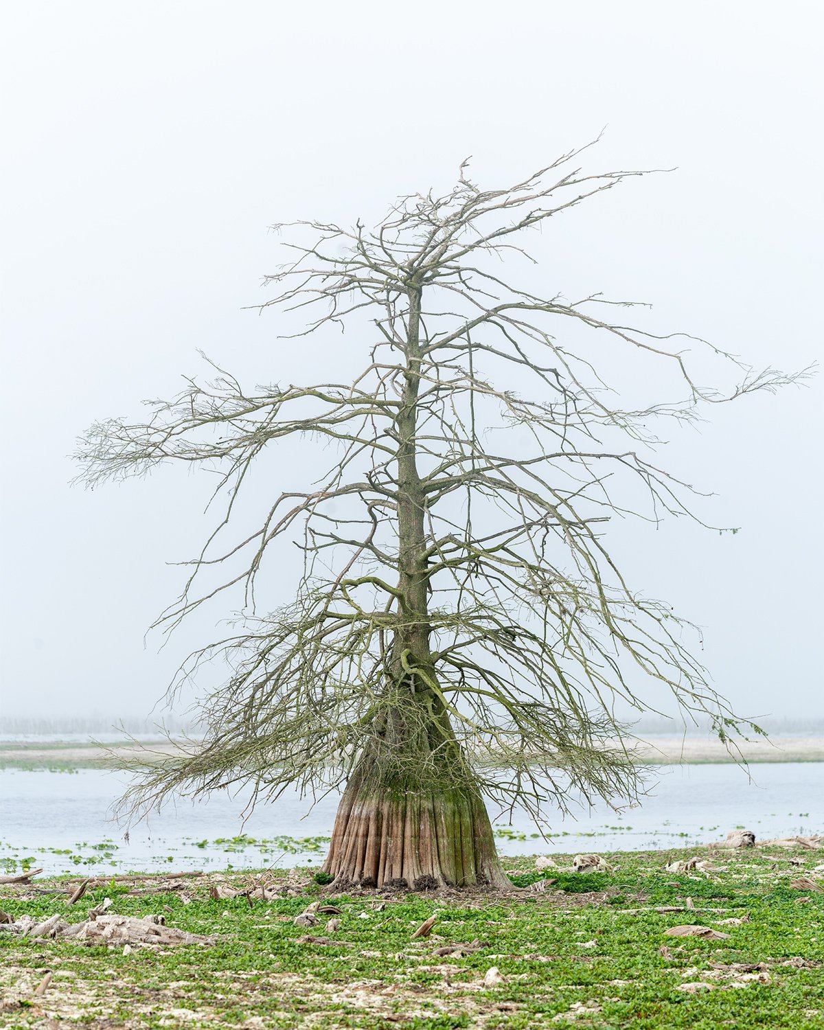
The bald cypress tree stands alone in the fog. Five to six feet of its base are temporarily exposed due to the drawdown.
I’m pretty sure I laughed out loud when I saw the tree. I didn’t think I’d actually make it.
I extended the legs of my tripod and moved closer.
In my excitement I stepped from a log and immediately sank into the mud. First one leg, then the other. Thankfully my tripod was fully extended and I managed to catch myself before falling face-first.
I took a moment to compose myself, then worked my legs free, careful not to lose my boots. I decided to stay close to the tree line for the rest of the morning.
I spent about thirty minutes circling the tree and photographing it as light sifted in and out of the fog. Then I packed up and headed back to the truck.
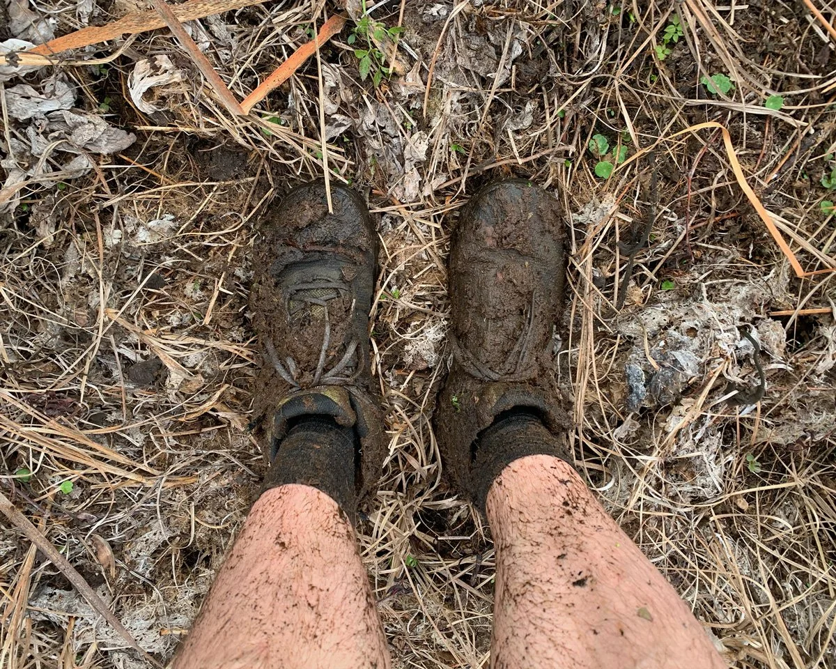
My boots and legs covered in mud
The parking lot was still empty when I returned. Concrete was a welcome sight. I rinsed the mud from my legs and changed into my sneakers.
By then the fog had mostly lifted, leaving me with another decision: drive home satisfied with the adventure so far, or continue to the dam and finish the original mission.
I chose the latter and headed for the dam.
In about a week the landscape I had just walked will start to vanish. The cans and bottles will disappear. The cypress graveyard will submerge, leaving the lone tree surrounded by water. My footprints will fade, and the temporary boat ramp will once again return to the bottom of the reservoir.
I captured the aerial photo at the dam, but to my surprise the water level looked the same as it had in November. I thought I’d be disappointed by that, but I wasn’t.
On the drive home I felt a sense of closure. Despite the many challenges of the past few months, I showed up. And for that I’m proud.
I’ll continue documenting the Ocklawaha River. But for now, this chapter feels finished.
If only temporarily.
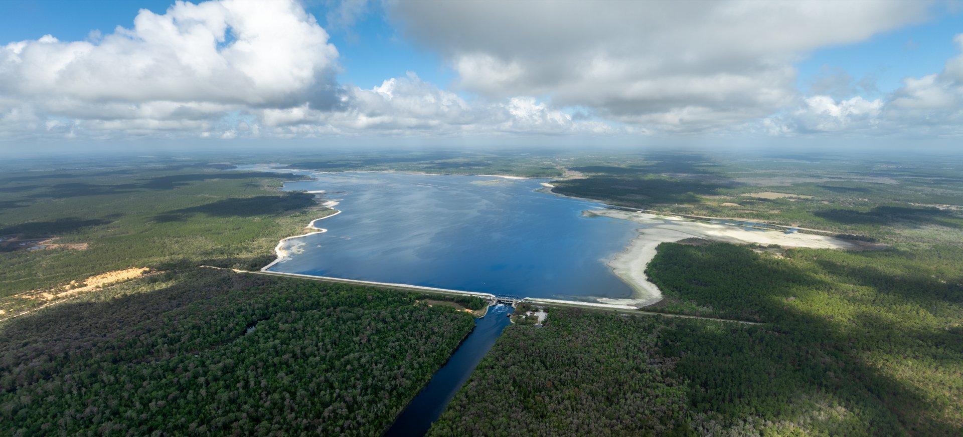
Rodman Reservoir during peak drawdown on March 6, 2026

Rodman Reservoir one month into drawdown on November 8, 2025
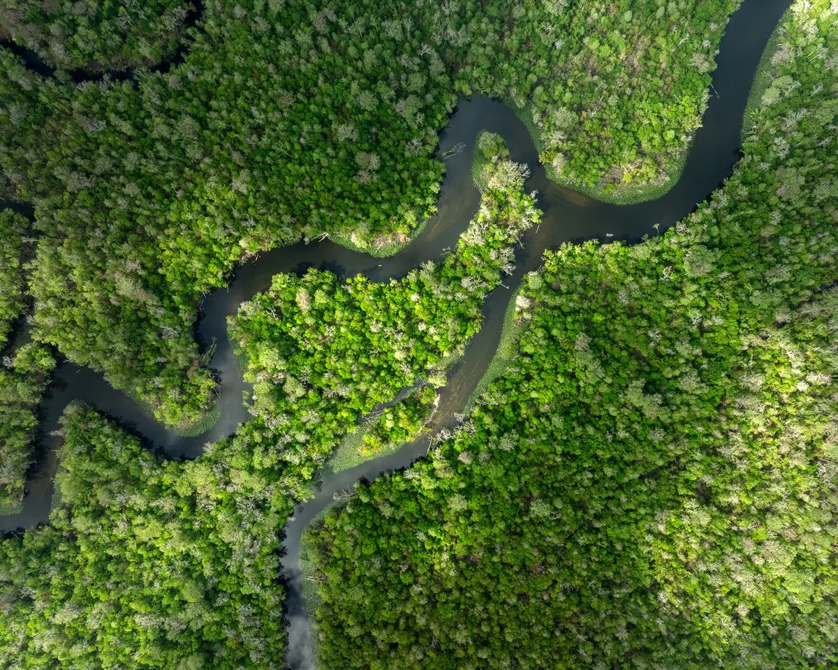
A section of the Ocklawaha River after the dam